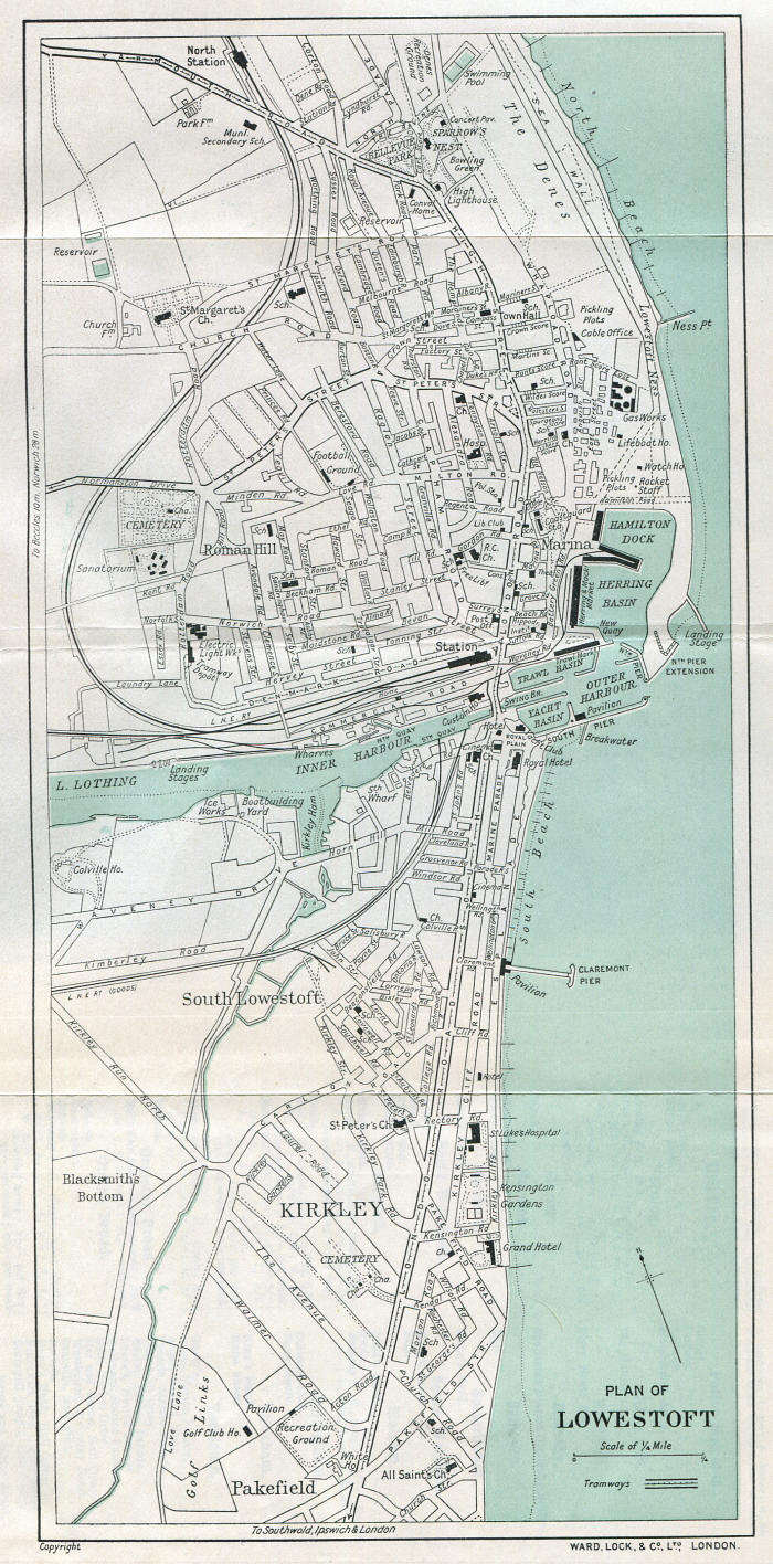
For those who are familiar with Lowestoft the layout of many of the roads has not changed much from the 1932 map below apart from the destruction of some areas by the introduction of the north and south spine road. Some of the now lost railway branch lines are evident and there were many more undeveloped open spaces.
During WW2 the coastal strip that included Lowestoft was a restricted area until it was relaxed much later in the war, being a likely invasion coast as well as Lowestoft itself being the home to no less than five naval bases as well as personnel to man the coastal defence guns and anti-aircraft sites.
Children of school age were evacuated to the midlands and many of the schools and other now unoccupied buildings were requisitioned for military purposes. The holiday industry was on hold but even the many holiday establishments, the hotels, guest houses and holiday camps were not enough to meet the accommodation requirements of the military and naval personnel that the war had brought in to the town and some residents remaining in the town were persuaded to take in service lodgers.
Lowestoft still had a number of ship building and repair yards which were kept in constant employment, mainly with slips to lake Lothing but some at Oulton Broad as well.

The Tramway Depot can be seen marked at the junction of Denmark Road with Rotterdam Road, on the north side of Lake Lothing. This is the area in which the town destructor was situated (see Glossary) and where it is believed that the 'destructor buzzer' which is mentioned in the text was situated, probably on a chimney.
The post-WW2 Gunton estate development is still open country and the now re-developed old golf course is shown at Pakefield. Most roads are still the same names as today except All Saints Road is marked as Church Road and the roads beyond All Saints and St. Margaret's Church at Pakefield are now in the sea!